Colorado Gazetteer
☰ Menu
US Gazetteer
Colorado
Counties
Cities
ZIP Codes
Features
US
>
Colorado
> Colorado Maps
Colorado Address Based Research and Map Tools
Advertisement
Address Based Research & Map Tools
Boundary Maps, Demographic Data, School Zones
Review boundary maps and recent demographic data for the
neighborhood
, city, county, ZIP Code, and school zone. July 1, 2023, data includes
home values, household income, percentage of homes owned, rented or vacant
, etc.
Static Overview Map of Colorado Counties
Maps of Colorado Congressional Districts
Reverse Geocoding: Place a Marker, Get Coordinates and Nearby Address
Geocoding: Use the form above for Address Research, Get Coordinates and a great deal more!
Interactive Map of Colorado Counties
Maps require javascript to view.
Adams
Alamosa
Arapahoe
Archuleta
Baca
Bent
Boulder
Broomfield
Chaffee
Cheyenne
Clear Creek
Conejos
Costilla
Crowley
Custer
Delta
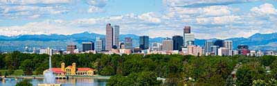
Denver
Dolores
Douglas
Eagle
El Paso
Elbert
Fremont
Garfield
Gilpin
Grand
Gunnison
Hinsdale
Huerfano
Jackson
Jefferson
Kiowa
Kit Carson
La Plata
Lake
Larimer
Las Animas
Lincoln
Logan
Mesa
Mineral
Moffat
Montezuma
Montrose
Morgan
Otero
Ouray
Park
Phillips
Pitkin
Prowers
Pueblo
Rio Blanco
Rio Grande
Routt
Saguache
San Juan
San Miguel
Sedgwick
Summit
Teller
Washington
Weld
Yuma
Colorado Research Tools
Evaluate Demographic Data
Cities, ZIP Codes, & Neighborhoods
Quick & Easy Methods!
Research Neighborhoods
Home Values, School Zones & Diversity
Instant Data Access!
Rank Cities, Towns & ZIP Codes
by Population, Income & Diversity
Sorted by Highest or Lowest!
Maps & Driving Directions
to Physical, Cultural & Historic Features
Get Information Now!!
Colorado Census Data Comparison Tool
Compare Colorado July 1, 2023 Data
Data
:
Population
Population Density
Diversity Index
Housing Affordability Index
Wealth Index
Locations
:
Cities & Towns
Counties
ZIP Codes
Highest or Lowest
:
Show Highest Values
Show Lowest Values
Results
:
Show 20 Results
Show 200 Results
Colorado
Colorado Civil Features
Colorado Census Data
Colorado Historic Landmarks
Colorado Schools
Research a Colorado Address
Advertisement
Advertisement